The CODATA Task Group on Linked Open Data for Global Disaster Risk Research (LODGD) has assisted in providing data relating to the recent NZ earthquake.
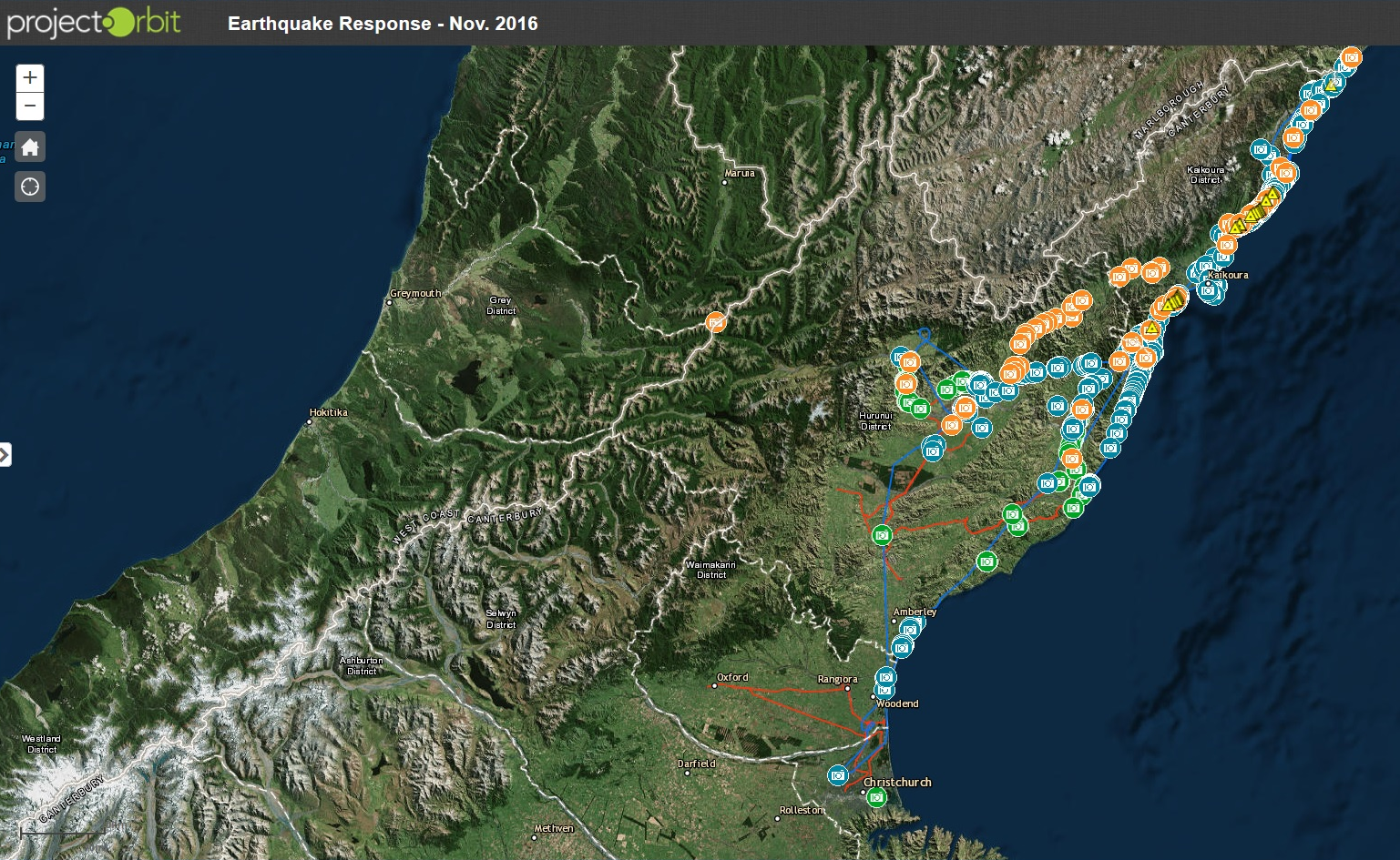
Tonkin+Taylor is collating geo-spatial information for the NZ Earthquake Commission on the damage caused by the 7.8 Magnitude Kaikoura Earthquake which can be accessed through a web-based viewer for use by Whole of Government, and also by response and recovery agencies, engineers and researchers. This information includes imagery taken from helicopters, aircraft and satellites, in particular the TripleSat (Chinese satellite) sourced through colleagues in the CODATA Task Group. The data includes 15 high res images observed in 14th and 16th after the earthquake, both with 3m and 0.8 resolution, provided by two Chinese commercial satellites. The platform that was used to organise the Chinese satellite data is based on China-GEOSS.
The earthquake, which occurred at 0002 hrs (NZ time) on 14 November 2016, caused major damage and disruption to the main transport network (Road and Rail) in the Upper South Island, and this information is therefore also being used by the New Zealand Transport Agency for recovery planning purposes.
Bapon Fakhruddin, co-chair of CODATA LODGD and Tonkin+Taylor
Li Guoqing, co-chair of CODATA LODGD, RADI and China-GEOSS