Category Archives: Uncategorized
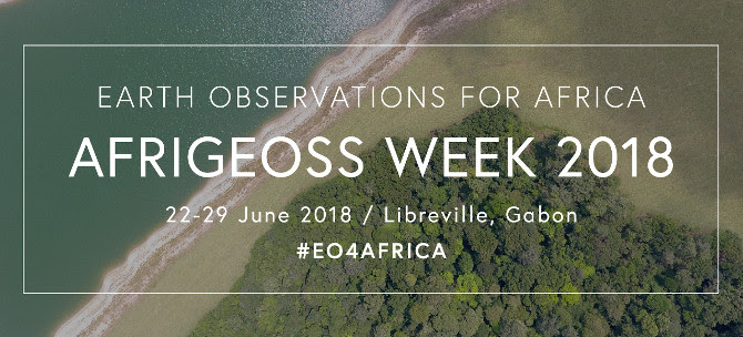
Register now! AfriGEOSS Week 2018
The AfriGEOSS Week 2018 will take place from 22 to 29 June 2018. The 3rd AfriGEOSS Symposium will be held during AfriGEOSS Week, from 26 to 28 June 2018 with some training sessions taking place beforehand.
The Symposium is hosted by the Agence Gabonaise d’Etudes et d’Observations Spatiales (AGEOS) and the theme is “Building smarter Earth observations to support sustainable development policies”.
The objectives include:
- Engage with end users, particularly policy and decision makers, to understand information needs for evidence-based policy-making and raise awareness on the value of Earth observations in meeting those needs;
- Showcase the use of Earth observations in implementing the United Nations Sustainable Development Goals (SDGs) and development policies at national and regional levels;
- Reinforce dialogue on Earth observations priorities in Africa and promote or build synergies with ongoing and planned Earth observations initiatives at the national, regional and international levels – to draw linkages with the implementation of the African Space Policy according to development policies;
- Strengthen regional and national thematic Earth observations coordination mechanisms to broaden African participation in the Group on Earth Observations and AfriGEOSS activities; and
- Review the implementation of the 2017 AfriGEOSS Symposium outcomes and contributions, and establish a mechanism of Monitoring and Evaluation for the future.
For more information and registration visit the AfriGEOSS Week website or contact symposium@afrigeoss.org.
Register Now: June 14 Symposium on Statistics and Data Science for a Cyber Secure Internet of Things


Statistics and Data Science for a Cyber Secure Internet of Things
Rapid growth in the number of devices connected through the internet of things (IoT) poses major challenges to maintaining connectivity, functionality, and security, as demonstrated by prominent cyber attacks launched through IoT devices. Traditional approaches in cyber security such as firewalls and encryption aim to prevent malicious intrusion, however additional countermeasures and approaches are necessary to detect and respond to malicious behavior and to identify when devices or data are compromised.
The National Academies invite you to attend a symposium and webcast on Statistics and Data Science for a Cyber Secure Internet of Things on June 14, 2018 in Washington, DC. During the event, speakers will discuss the role of statistical models and theory for IoT and for detecting, overcoming, and neutralizing cyber attacks.
Date/Time: June 14, 2018 from 1-5 p.m. EDT
Location: Keck Center, Room 100
500 Fifth St. NW, Washington, DC 20001
Or via webcast
Register Now
e-AGE18: Call for Papers & Posters, Amman, Jordan, 2-3 December 2018
ASREN Publications The proceedings of the conference will be published at IEEE Xplore.
Call for Papers & Posters
Posters are also welcomed, for those interested, please send a summary in MS-Word format including title of the poster, name and affiliation of author(s) and a short abstract of maximum one page to: info@asrenorg.net
An effective poster presentation is not just a standard research paper stuck to a board. It should summarize your work with graphs and images to tell the story and should use text more sparingly. Featuring a poster at e-AGE will serve as an excellent advertisement for your work, and can act as a great conversation starter with e-AGE participants.
Call for Presentations
Renowned speakers and experts are also invited to give presentations and participate in panel discussions on latest developments in e-Infrastructure services and application areas, various aspects of R&E networks, telecommunications technologies and the Internet, industry and research case studies of e-Infrastructure use, etc..
Call for Participation
Representatives from academia, research, industry, telecom organizations, NRENs, and governments are invited to participate in e-AGE18 to share experiences and exchange knowledge in a wide of topics relevant to e-Infrastructure and services.
Interested participants can register HERE.
Language
New OWSD Fellowship for Early Career Women Scientists – Call for Applications
OWSD is very pleased to inform you that the Call for Applications for our new fellowships for Early Career Women Scientists is now open, and would like to ask for your assistance in distributing this announcement.
This Fellowship is a prestigious award of up to USD 50,000, generously provided by Canada’s International Development Research Centre (IDRC), and is offered to women scientists from Science and Technology Lagging Countries (STLCs) who have completed their PhDs in Science, Technology, Engineering and Mathematics (STEM) subjects and are employed at an academic or scientific research institute in one of the eligible countries. ECWS fellows will be supported for two years to continue their research at an international level while based at their home institutes, to build up research groups that will attract international visitors, and to link with industry.
The fellowship provides funding for a wide range of expenses, including equipment, consumables, research visits, exchanges and programmes, teaching and assistance, information resources, product development and linking with industry, outreach, communications and networking, and other expenses. A full list of eligible expenses is available in the Call for Applications. Fellows will also take part in two training workshops on leadership and entrepreneurial skills.
The application must be submitted through our online system. The link to the online application will be available on the OWSD website by 30 June 2018. However, all details about the application and the required supporting documents are already available on our website. We recommend that applicants begin to prepare their project proposals and applications immediately.
The Call for Applications is available online at: https://owsd.net/career-
The deadline for completed online applications is 31 August 2018.
The official language for the application is English; all information about the programme will also be available in French shortly.
A short video about the fellowship and how it will benefit women scientists starting their careers can also be viewed here: https://bit.ly/2qGY1F0, or on the OWSD website under the Call for Applications.
Please also find attached a poster which can be printed and posted. Again, we encourage you to share this opportunity with women scientists and others in your networks.
Questions about this fellowship can be sent to earlycareer@owsd.net.
For general enquiries about OWSD please write to owsd@owsd.net.
Geo4SDGs – a conference connecting geospatial with development community
Adopted in 2015, Agenda 2030 outlines 17 diverse set of goals that touch several domains, yet are systemically interconnected and entwined with each other. Any shift or change in one segment can and will impact several others. Which is why it’s crucial for multiple stakeholder communities to work collectively to be successful. What is required is coordination, communication, and cohesiveness of policies and program implementation that can be built upon reliable systems, tools and technologies. Invitation for NATIONAL SYMPOSIUM ON INDUSTRY ACADEMIA COLLABORATION FOR GEOSPATIAL TECHNOLOGIES – 2017 DURING 15-16 DECEMBER 2017
DURING 15-16 DECEMBER 2017
Greetings!
I take this opportunity to introduce CEPT University, Ahmedabad which is a leading institution offering Under-Graduate, Post-Graduate and Doctoral programme in the areas of natural and built environment related disciplines in Architecture, Planning, Technology, Design, and Management. The University engages in academic, research, consultancy and outreach activities. It organizes national and international events periodically for the knowledge exchange, dissemination as well as networking for the young students.This December, CEPT University is organizing a ‘National Symposium on Industr
Experts from academia and industry will join hands and discuss about the emerging trends in geospatial those goals industry and the role of academia in reaching. Vision on GIS industries and trends, deciding roadmaps in GIS and have better visibility in working together for the benefit of both academia and industry. A special session is organized for the industry to discuss with the students and the academia on their requirements and the respective changes needed in the academic system.
This event is open for geospatial industry, academia, government and NGO. It is expected to provide an excellent platform for the discussion on need, limitations, challenges and opportunities for establishing the collaboration between the geospatial industry and the academia, the scientists, and the government. The University expects large number of participants from geospatial industry, academia and government. Two days long discussion will open the opportunities to the geospatial industries, through interaction, sharing of innovations and showcasing the products and respective upgrades to the core group of academia, students, government officials, scientists and other interested groups.
This symposium is intended to open the gates for the collaboration and strengthening the ecosystem of Geospatial Technology
I am very glad to personally invite you to participate in 2-Day event. Please block the dates for these events. We shall be happy to welcome you in Ahmedabad
Prof. Anjana Vyas, Ph D
Executive Director,
Centre for Advanced Geomatics, CRDF
Summary of Linked Open Data for Global Disaster Risk Research activity involving Dr Bapon Fakhruddin and Professor Virginia Murray

Dr Bapon Fakhruddin
The fourth Pacific Meteorological Council and second Pacific Meteorological Ministers Meeting (PMMM) was held in Honiara, Solomon Islands, 14-17 August, 2017.
Dr Bapon Fakhruddin’s presentation on end-to-end impact based multi-hazard early warning systems and disaster loss data collection for risk assessment, beginning with community ownership and engagement, was exceptionally well received. More
Disaster Risk and Resilience Roundtable, 19 June 2017, Wellington, New Zealand

Professor Virginia Murray
The Global Platform disaster loss data working session reinvigorated a high level roundtable followed a seminar on Global experiences on managing disaster risk – rethinking NZ’s policy approach by Elizabeth Longworth (ex UN Office for Disaster Risk Reduction . The roundtable emphasized to strengthen risk governance system of New Zealand. There is a very strong business case to be made for investing in disaster risk reduction. It has been estimated that an annual global investment of USD 6 billion in disaster risk management strategies would generate USD 360 billion worth of benefits in terms of reducing risk. On that basis, New Zealand might expect a return on investment of 60 times for every dollar spent on reducing disaster risk. In terms of creating shared value, investment in disaster risk management has co-benefits of strengthening resilience, competitiveness and sustainability.
The estimates for direct losses are considered to be perhaps 50% under-reported due to the pervasive nature of smaller scale, localised and recurring disasters. It is concerning that, internationally, the mortality and economic losses from extensive disaster risk are trending upwards. For New Zealand and its Pacific Island neighbours, climate change will magnify disaster risk and increase the costs. With the New Zealand economy heavily reliant on the agricultural sector, it is particularly exposed to weather-related events.
In the same way that New Zealand’s approach to social investment requires improved data and analysis, so too does the production of NZ-based risk information and integrated databases. Greater sensitivity as to the causes and consequences of disaster risk could strengthen accountabilities as to disaster impacts.
A modern-day approach to risk governance also requires greater inclusiveness and transparency. New Zealand needs to pursue an ‘NZ-Inc’ approach. The nature of disaster risk necessitates a whole-of-government response. Dr Bapon Fakhruddin attended the roundtable as an expert.
Workshop on developing a disaster loss database for New Zealand, 28 September 2017
MCDEM will be holding an initial all day workshop on 28 September to discuss all elements of the Loss Database Project. 5th Global Platform for Disaster Risk Reduction (DRR) was held in Mexico between 22-26 May 2017. The Platform was hosted by the United Nations Office for Disaster Risk Reduction (UNISDR) and the Mexican government to support the continual progress assessments of the Sendai Framework (SFDRR) implementation. The New Zealand delegation was led by Special Envoy for Disaster Risk Management (Philip Gibson, MFAT) accompanied by officials from MFAT (1) and MCDEM (3), plus a wider NZ Inc. delegation of 20 which comprised representation from academia, NGOs, local government and private sector providers.
Following the Platform, a number of key pieces of work are in progress, or need to be considered to give effect to the Framework, put priorities into action and report on the Global Indicators. Of note, these are:
- Finalising the National Disaster Resilience Strategy
- Developing the concept for a National Platform for DRR
- Developing a National Disaster Loss Database and routine disaster loss reporting
- Project to develop better methods of pricing risk and forecasting losses
The first project MCDEM wish to seek your engagement on is the Loss Database. This is something given consideration to in the past, but is now critical due to its significance to future Sendai reporting. Unlike previous reporting on the Hyogo Framework for Action that focussed on qualitative data on inputs and outputs, Sendai reporting is focussed on outcomes, i.e. losses from disasters, and whether seeing a downwards trend.
ISCRAM Asia Pacific 2018 Conference, Wellington, New Zealand
Dr Bapon Fakhruddin and Professor Virginia Murray will be chair a session on disaster data Issues for situational awareness in the ISCRAM Asia Pacific Conference in late 2018 (http://www.confer.co.nz/iscramasiapacific2018/)
ENERGIC-OD: International co-operation to promote FAIR GIS Open Data and the growth of European SMEs
This post was written by Giuseppe Maio and Jedrzej Czarnota. Giuseppe is a Research Assistant working on innovation at Trilateral Research. You can contact him at giuseppe.maio@trilateralresearch.com . Giuseppe’s twitter handle is @pepmaio.
Jedrzej is a Research Analyst at Trilateral Research. He specialises in innovation management and technology development. You can contact Jedrzej at Jedrzej.czarnota@trilateralresearch.com, and his Twitter is @jedczar.
The value of open data business is increasing at a very fast pace. The open data market is projected to be worth over 75 billion in 2020. Yet, accessing this expanding market is not easy. Open data sources are difficult to find, not interoperable and hardly reusable, as argued by a recent Open Knowledge Foundation’s report.
ENERGIC-OD, a European Commission project, aims precisely to facilitate access to the open data market in the Geographic Information System (GIS) sector. The project built a pan-European Virtual Hub (pEVH) simplifying the access to and the use of GIS open data in Europe. Readers can view and utilise the pEVH here. pEVH brokers together an infinite number of geo-spatial open data sources, harmonising them, rendering them accessible through a single API and ready to be reused for various purposes. pEVH-brokered data is available under freemium licence: data is free to use and users can pay for some extra features of the pEVH. The freemium model guarantees the promotion of knowledge exchange, the extraction of value from such an exchange and from the services provided by the actors involved.

ENERGIC-OD functions as a data facilitator by improving the quality of the open data available in the GIS sector: the pEVH was designed to ensure that data is aligned with FAIR principles. These principles advocate that open data should be easy to Find, Accessible, Interoperable and freely Reusable. pEVH-brokered data is FAIR as the single website where data is stored allows GIS OD sources to be much more findable than before; the single API adopted by ENERGIC-OD makes data usable and interoperable; finally, the freemium model guarantees the re-usability of the data.
To demonstrate the viability of the pEVH, ENERGIC-OD consortium developed 10 applications based on VH-brokered data. These applications range from an app promoting communication between citizens and land consolidation authorities, to a coastline monitoring system that allows people to participate in the scientific observation of coastlines.
ENERGIC-OD is committed to enhance innovativeness among SMEs and incentivise local economic development across Europe. Such objectives appear achievable for three reasons.
Firstly, the FAIR principles characterising pEVH-brokered data facilitated SMEs’ ability to utilise GIS data sources, as ENERGIC-OD lowers entry barriers, preventing the usage of such data.
Secondly, the main features of GIS render this branch of IT extremely suitable for business (Azaz 2011). These features are: 1) spatial imaging, namely GIS’s ability to convey information with a spatial dimension; 2) database management: GIS’s capability of storing, manipulating and providing data; 3) decision modelling, or GIS’s potential to provide intelligence supporting decision making; 4) designing and planning, namely GIS’s potential as a design tool (Azaz 2011). Digital mapping, marketing, transportation and logistics, design and engineering, etc. are some of the sectors which have successfully utilised GIS for business. GIS’s potential can be further exploited coupling GIS systems with modelling tools, the so called “intelligent GIS” (Birkin et al 1995). The retail sector has already utilised intelligent GIS integrating shops’ data and spatial pattern data over time to design spatial interaction models and forecast maintenance costs as well as revenue streams (Altaweel 2016). An example of ENERGIC-OD intelligent GIS app is Natural hazard assessment for Agriculture application. Using satellite imagery, this app delivers predictions of the yield reduction in specific crops based on statistical models, considering factors such as draught, humidity, frost, etc.
Thirdly, small and medium enterprises are the greatest beneficiaries of the open data movement, as they are guaranteed free access to data they would not normally have access to and they are more likely to take advantage of open data and become drivers of innovation (Verhulst and Caplan 2015). SMEs constitute the backbone of the European economy and ENERGIC-OD thus functions as a facilitator for these businesses, enabling them, through the put in practice of FAIR principles, to tap more easily into the GIS open data market.
An initial market research conducted by Trilateral Research, a technology consultancy member of the ENERGIC- OD consortium, confirms SMEs’ high interest in the pEVH. These enterprises will, in the next years, drive innovation and economic growth across Europe. ENERGIC-OD thus represents an example of international cooperation to promote FAIR GIS open data and the growth and development of European SMEs.
References
Altaweel, M. (2016). GIS and Small Business Planning ~ GIS Lounge. [online] GIS Lounge. Available at: https://www.gislounge.com/gis-small-business-planning/ [Accessed 11 Sep. 2017].
Azaz, L. (2011). The use of Geographic Information System (GIS) in Business. International Conference on Humanities, Geography and Economics, pp.299-303.
Birkin, M., Clarke, G. and Clarke, M. (1995). GIS for Business and Service Planning. [online] Available at: http://www.geos.ed.ac.uk/~gisteac/gis_book_abridged/files/ch51.pdf [Accessed 11 Sep. 2017].
Verhulst, S. and Caplan, R. (2015). Open Data.A Twenty-First-Century Asset for Small and Medium-Sized Enterprises. [online] Available at: http://www.thegovlab.org/static/files/publications/OpenData-and-SME-Final-Aug2015.pdf [Accessed 11 Sep. 2017].
Report to ICTP, Trieste CODATA-RDA Research Data Science Summer School (10th – 21st July, 2017)
This post was written by Neema Simon SUMARI, a Tanzanian national working at the Sokoine University of Agriculture (SUA), at the time of writing. Currently, She is a Ph.D. researcher specializing in Remote Sensing, Cartography and Geographical Information Engineering at the University of Wuhan in China. She holds an M.Sc. and B.Sc., both in Computer Science, from the Alabama Agriculture and Mechanical University (A&M) in the United States of America. Her participation was kindly supported by ICTP and Nature Publishing, via CODATA.
I first heard about CODATA in July 2016 when I attended an International Workshop in Beijing in 2016. I was very happy and excited to meet new people there, learning new things and seeing new places. It was the first time I had participated in an International workshop/conference, and the first time to experience this in China where I am now doing my Ph.D. Through that workshop, I made lots of new friends and built a strong network of people in and out of my field of study.
The CODATA-RDA Research Data Science Summer School in Trieste, Italy, in July 2017, was the best for me. The summer school was amazing, we exchanged academic knowledge as well as building on our existing networks. I wanted to learn and meet new people, ideas and experience different cultures and CODATA and Springer-Nature supported me in attaining these goals. It has been amongst the best experiences in my life. I met a lot of fascinating people from all over the world, expert professors whose lectures were very interesting and helpful to my academic career. I created strong friendships that I hope I will be able to maintain over the next few years if not more.
At the closing session ceremony, Dr. Simon Hodson, Executive Director of CODATA, asked the participants: “so, what have you learned? and what will you do next?” What I have learned was the idea of Open Science and its principles was a major theme of the summer school. I have learned different issues on why data cannot be shared, how can be analyzed, which data has long term value as well as benefits of storing, protecting, sharing, and publishing data among research scientists. It’s true that most of the researchers would like their data to be publicly stored and accessible by other researchers, however, this is not easy for researchers who do not have clearly defined ways to do this, or do not know how to make their data accessible to others. Knowledge of data management plans for the hosting research institutes is required to ensure that researchers can define ways to store their datasets in a publicly accessible way after their experiments are done. Once the research data is stored in a publicly accessible manner, it then needs to be preserved in a format which can be reused by other researchers. In this summer school, the courses that were taught were: Programming-in-R, Cloud Computing, UNIX Shell, ggplot2, Data Visualisation, SQL, Machine Learning, Data Science Profession, Artificial Neural Networks, Research Computational Infrastructure, HOC and HTC, Research Data Management. These courses gave us very good skills and knowledge about Data Science which can help us to facilitate the sharing of data – it was a great experience. I now know why Open Access and data sharing is important and I will apply and share this knowledge to my professional and social media networks.
Last but not the least, was the wonderful arrangement of having helpers to assist us with any logistical problems occurring during the practical sessions and the use of pink sticker was an outstanding method. It was one of the most enjoyable and informative moments of my life.
Thanks to CODATA, RDA, ICTP, and Springer-Nature for your support, as well as to all my fellow participants for making it possible and fun.